This week I’m delighted to welcome Senior Researcher Josh Ostroski back to The Intelligent Edge. If you’re a long-time reader, you’ll know that Josh is our go-to guy on real estate research here at HBG, and this week he has a great article to share on a very clever way to find property information. Take it away, Josh! ~Helen
I had planned to write a blog post about some of the things I’ve learned in my 15 years as a Prospect Researcher since all I ever seem to write about is real estate. However, I’ve been noticing a new trend while researching properties that I think would be helpful for everyone – Assessor GIS Mapping – so I decided to go for a real estate theme for a blog post again.
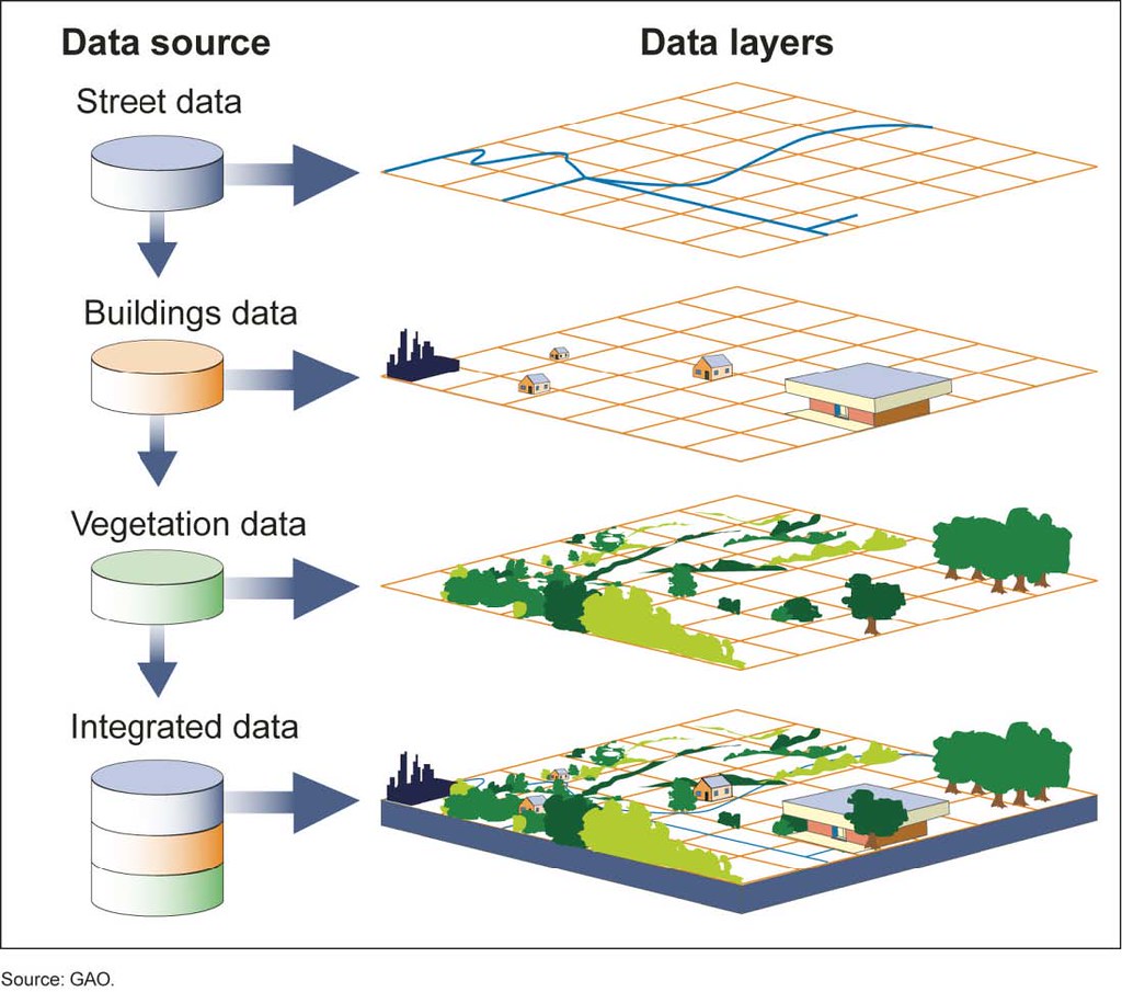
Geographic Information System, or GIS mapping for short, is not necessarily a new technology, but I’ve noticed that it has popped up on most of the assessor sites now. I’ve found it so helpful that I wanted to share it so that more in the prospect development world are aware of it.
What is GIS Mapping?
GIS Mapping allows you to search for a property by address or by location and you will be able to see the property lines and, in most cases at least, who owns it and basic information about the property. Like all assessor sites, not all counties in the country share the same information and some are more robust than others.
Each site has its unique features and allows you to see different information, so be patient and play with each county (or sometimes state) sites. Even if it doesn’t give you all the information you need, you can at least have a visual of what the property looks like. Then you can use what you know and other resources to find out more specific information about the property. Often times the traditional assessor site will have more robust information on its site about the property.
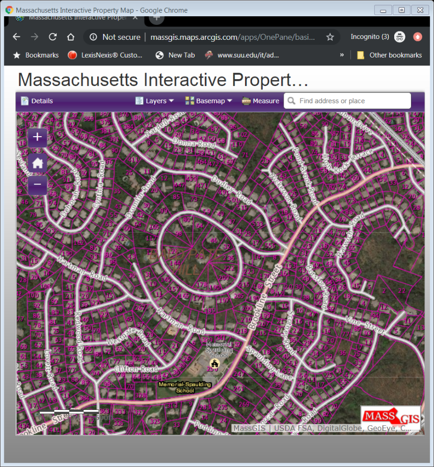
Here is an example of what the map looks like. Each separate lot is outlined and you can simply click on the lot (be aware that some GIS Maps require you click on a tool in order for the assessor information to pop up), and the information will come up.
How is GIS Mapping Helpful?
I always use this feature when I’m looking at a property that has multiple lots; that way I can see what the property actually looks like. I’ve also found it helpful when someone may have multiple lots, but they are owned by different LLC’s or by family members.
Another way it is useful is when a mailing address and a property address don’t match. Sometimes that could be because the property is split between different streets or the owners bought an adjacent lot at a later date and use that mailing address.
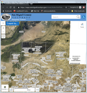
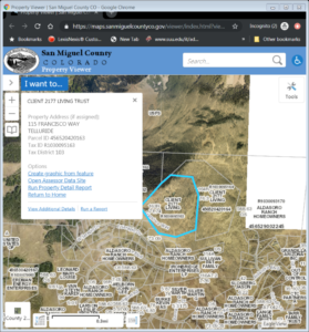
Below is a screenshot from the San Miguel County, Colorado, GIS Mapping site. The property in question was located at 115 Francisco, Telluride, CO, which is Tom Cruise’s estate. It has been on the market for $59M.
What this shows us is that the property is owned by Client 2177 Living Trust, which if you run the property report shows an address in Los Angeles, CA, that is home to Chapman Bird Grey & Tessler, a Hollywood business management firm that Tom Cruise has been associated with. The other thing it shows is the properties adjacent to the main home that are owned by the same entity.
In this example, the adjacent properties are owned by the same name, but I have often found the names can be different but have the same mailing address. One example I came across just the other day was a home in New Jersey that consisted of six separate lots; each lot owned by a different limited liability company (LLC) (ex: 123 Briar Lane Acquisiton LLC, 129 Briar Lane Acquisiton LLC).
I always use a satellite view when using the GIS Mapping tool (I actually always use satellite view in life); that way you can really see what the home and property look like. You can also sometimes tell if a home was recently renovated or differs from what the assessment records indicate, which could be due to a delay in new information being uploaded.
Another example of how this has been very useful was a request from a gift officer after a meeting with a prospect. The prospect had mentioned in passing that he was selling some land he had accumulated over the years to a developer. It turned out he owned dozens of separate lots, all under different LLC’s and many with different mailing addresses. By using the GIS Map, I was able to click on all the lots in the area and determine if they were his or not.
He was indeed selling them off and to a developer that was building a new golf course community. We were also able to tell which lots he had recently sold and for how much. With traditional resources, it would have taken me much much longer to do and I don’t think it would have been as accurate.
How to Find GIS Mapping Tools
NETROnline.com is a great resource for individual assessor sites, including listing GIS Mapping links. The assessor sites are under the Public Records Online tab.
You can also do a search for “[County Name] Assessor GIS Map” and you will probably have luck. I’ve rarely found a county that does not have this capability. There are some outliers: Massachusetts, for example, does not do it by county, but the entire state has one map you can search.
Let me know what you think of GIS mapping tools, and what other interesting tools you use to find real estate information.


